
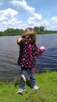
Fishing
As society becomes more complex, people are recognizing the importance of recreational activities in reducing stress and maintaining good mental and physical health. Fishing accommodates a diverse audience from those seeking a quiet place to the family searching for a shared activity. Anglers fish for a variety of reasons including food, relaxation, excitement, solitude, escape from the daily routine and the challenge fishing provides.
Management
Polk County Conservation Board attempts to provide anglers with the best fishing possible. All ponds/lakes have submerged "tree reefs" which provide fish hiding spots. Click on the Contour Maps above to see where those have been placed. Annually, Polk County Conservation staff stocks nearly 4,000 catfish; 50,000 walleye and largemouth bass; and 2,000 6" walleye which are released into our lake and park ponds.
You can help improve the areas you fish by releasing all bass. Bass are predators that eat smaller fish. When they are removed, the number of bluegill and other pan fish increase and can quickly become stunted. When you're fishing you should quickly release all bass and take the bluegills home to eat. Bluegills are some of the best fish to eat anyway. Staff also encourages the public to release walleye that are 14" and under.
Fishing Basics
- Ask permission before fishing a private pond
- Buy a fishing license if you're 16 or older
- Be careful when walking near the water
- Never leave your garbage behind
- Measure a fish from the tip of the snout to the end of the tail fin
Fishing Links
Easter Lake
Constructed in 1967
Surface Area: 171 acres
Maximum depth: 26 feet
Average depth: 11 feet
Average fish size
Bass 1 ½ lbs
Catfish 3 lbs
Crappie 3/4 lbs (9-12 inches)
Walleye 1 ½ lbs (predominate predator)
Records
Bass 9.95 lbs
Catfish 15 lbs
Crappie 3/4 lbs
Walleye 10 lbs
Hot spots
With a south wind fish the north side jetties
Fish for walleye off the dam
Bait/lures
Catfish - chicken liver
Crappie - jigs or minnows
Rules
No wake
Other
Boat ramp accessible from south entrance; ADA fishing pier/house on north shore
Average size fish
Bass 2 lbs
Bluegill 3/4 lbs (9 ½ inches)
Catfish 2 lbs
Records
Bass 5 lbs
Catfish 7 lbs
Crappie 3/4 lbs (12 in)
Hot spots
During spawning season, crappie and bluegill will be in the bays
Bluegill in the coves in late May and early June
Baits/Lures
Bluegill - try fly fishing, the lake can be waded in several places, especially the southwestern bay
Crappie - jigs or minnow
Rules
Electric boat motors only
Other
Jester Park
Discovery Pond Contour Pond Map
Maximum depth: 8 feet
Average depth: 5 feet
Bass, bluegill, green sunfish, and crappie. Most fish are small but plentiful. Good for beginning anglers. Look for submerged brush piles. Ice fish using wax worms or minnows. Teal and Skull ponds have roadside access only. Boat ramp access to Saylorville Lake.
Thomas Mitchell Park
Constructed in 1971
Surface area: 6 acres
Maximum depth: 18.6 feet
Average depth: 7.4 feet
Bait/lures
Bluegill - worm with bobber
Bass - rattletraps in spring rubber worm on bottom in summer
Catfish - worms, stink baits, or chicken liver on the bottom or using a bobber
Rules
Bass must be 18 inches or larger
Other
Good bait fishing in camp creek
Algae becomes a problem in summer
Yellow Banks Park
Surface area: 5 acres
Maximum depth: 14 feet
Average depth: 8 feet
Average size of fish
Bass 14 inches
Bluegill 7 inches
Catfish 1 1/2 lbs
Records
Bass 6 1/2 lbs (caught and released)
Catfish 20 lbs
Hot spots
Away from the dam People have great success using a belly boat
Baits/lures
Try something different
Rules
Bass must be 18 inches or larger
Carry in boats allowed with electric motors only
Other
Boat ramp access to Des Moines River